 vesseltracker.com
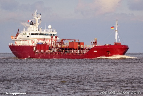
Vessel BUNKER BAY IMO: 9377092, MMSI: 224448000 Bunkering Tanker
UTC, 36.13115, -5.41828, course: 181, speed: 0
UTC, 36.13117, -5.41829, course: 181, speed: 0
2026-01-25 07:51:16 UTC, 36.13117, -5.41828, course: 181, speed: 0
Live AIS position:
UTC. Near Algeciras),
updated 2026-01-25 07:51:16 UTC.
Find the position of the vessel BUNKER BAY on the map. The latter are known coordinates and path.
marine traffic ship tracker show on live map
The current position of vessel BUNKER BAY is 36.13117 lat / -5.41828 lng. Updated: 2026-01-25 07:51:16 UTCCurrently sailing under the flag of Spain
BUNKER BAY built in 2006 year
Deadweight:
4225 tDetails:
Last coordinates of the vessel:
UTC, 36.13116, -5.41828, course: 180, speed: 0UTC, 36.13115, -5.41828, course: 181, speed: 0
UTC, 36.13117, -5.41829, course: 181, speed: 0
2026-01-25 07:51:16 UTC, 36.13117, -5.41828, course: 181, speed: 0